STREAM UP
SVS Ltd has been in talks to provide surveying services for large scale future cycle route, traffic calming and pedestrianisation programs. One particular call has been for our mobile Ground Penetrating Radar (GPR) capability.
Having run the IDS Stream “C” system for a number of years, to great effect, we considered ourselves to be well rehearsed in the application of mobile GPR however we recognised that the speed and width limitation of this device would not address the requirements of the project.
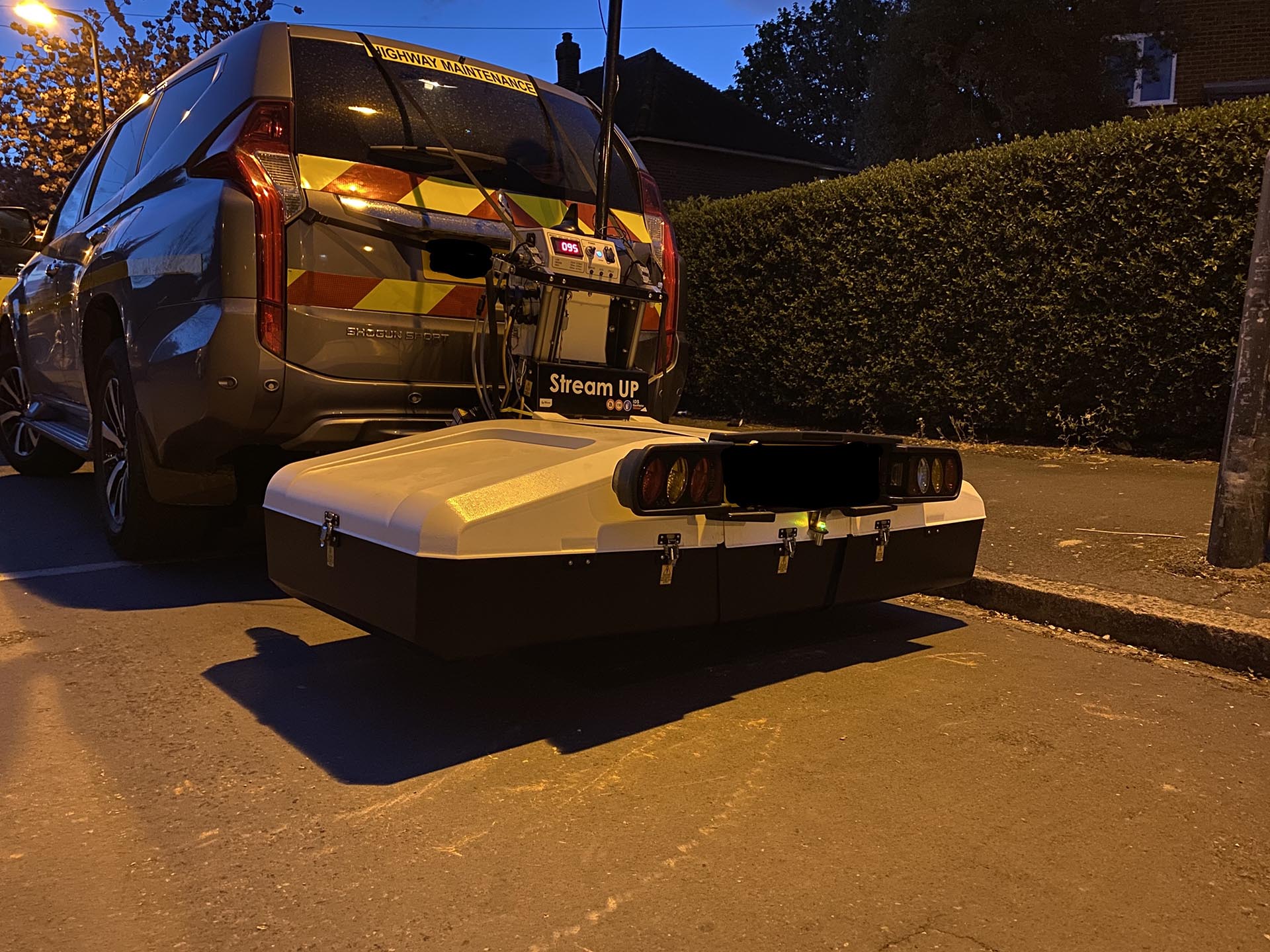
After a brief assessment period reviewing a variety of capable devices we decided to invest in the Stream Up system. As you can see from the image this is a sleek compact system that can be easily deployed from the rear of a vehicle. It enables us to gather mass data sets at a far more effective road speed across a greater area on each transect.
Making the whole process time efficient with less of an impact to the local environment, businesses and residents
PROJECT
The design team required an initial look into the site and so requested a desktop (QL D, C2, STATS) search be carried out in conjunction with an MGPR exercise within the specified site parameters.
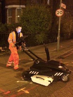
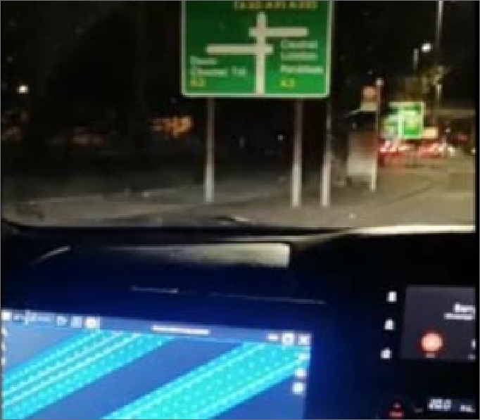
Deploying the Stream Up system during night working hours meant minimal disruption to road users and removed the need to install a traffic management system, all together.
On this occasion it was decided to deploy the system between #2 survey vehicles to have an obvious presence on site for all road users to see and to offer greater protection to the MGPR system while creating a safer environment for our operatives
“This ability to take an initial look into what may lay beneath a site in such a non-disruptive manor is so valuable to all vested parties. The data provided is visually superior to anything we’ve seen to date and provides real assistance to the design engineers and their budgets”
Simon Bailey FCInstCES
Managing Director
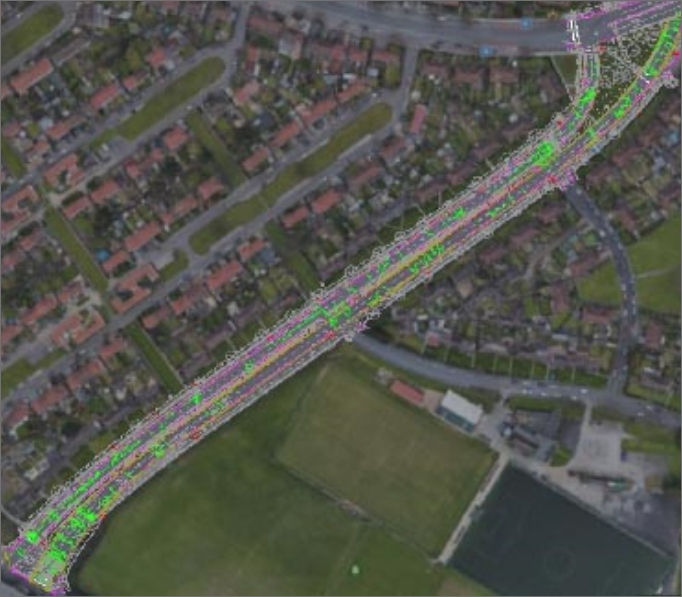
“Track map”
As the #2 vehicles traversed the site they were able to follow their progress by utilising the “track map” facility running in real time and easy to view from within the cabin of the lead vehicle. Enabling the survey team to establish if appropriate coverage was being achieved removing the possibility of any data gaps.
Captured data was post processed through the IQ Maps software, providing incredible visual data, in this instance down to 2.5m in depth. The functionality of the software allows the user to quickly view slice data (based on the google earth back drop) through the acquired depth of the survey making identification of linear features, such as buried utility services and subsurface structures, such as IC / MH chambers incredibly straight forward to visualise and map.
Supplementary:
The initial mobile GPR exercise enhanced with the findings of the desktop search provided the design team with a greater understanding of the site, allowing initial concepts to be drawn and pushed through.
Upon construction it is widely acknowledged the initial works would be supplemented with a full Pas128 survey of the surrounding footpaths and “lift and dip” data acquisition and surveying of all IC / MH chambers across the entire site